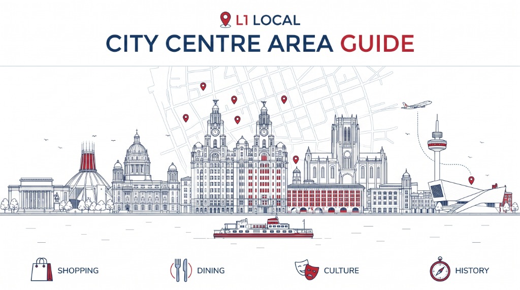
Liverpool city centre is compact enough to cover on foot, but it makes more sense when you split it into smaller sections rather than treating it as one place.
Lime Street and William Brown Street are the arrival and civic end. Liverpool ONE and Church Street form the shopping core. Bold Street and Ropewalks hold the independent shops, restaurants, bars and FACT. Castle Street connects the commercial district to the river. Pier Head and the Royal Albert Dock are a separate waterfront area again.
Knowing which part you actually need saves a lot of walking.

Which station for which part of town
- Liverpool Central is the closest Merseyrail stop for Bold Street, Church Street and Ropewalks. Lime Street handles mainline and regional trains.
- Lime Street station faces St George's Hall, Central Library, World Museum and the Walker Art Gallery.
- Liverpool ONE and Church Street are the shopping core. Bold Street and Ropewalks hold most of the independent shops, cafes and bars.
- Castle Street links the business district to Pier Head and the waterfront.
- The Maritime Museum and International Slavery Museum at the Royal Albert Dock are closed for redevelopment. The Museum of Liverpool nearby stays open.
- Pick two neighbouring sections and spend time there rather than trying to walk the whole centre in one visit.
Which part of the city centre do you need?
| Area | Useful for |
|---|---|
| Lime Street and St George's Quarter | Mainline trains, St George's Hall, Central Library, World Museum and the Walker Art Gallery |
| Liverpool ONE and the retail core | High-street shopping, restaurants, cinema and Liverpool ONE Bus Station |
| Bold Street and Ropewalks | Independent shops, restaurants, coffee, FACT, bars and nightlife |
| Castle Street and Dale Street | Restaurants, offices, Liverpool Town Hall and the walk towards Pier Head |
| Pier Head and the waterfront | Museum of Liverpool, the Three Graces, ferry terminal, Royal Albert Dock and King's Dock |
| Hope Street and the Georgian Quarter | The two cathedrals, theatres, Philharmonic Hall, university buildings and Georgian streets |
The boundaries overlap, and that is normal. Duke Street, for example, connects Ropewalks, Liverpool ONE and the route towards the waterfront.
Arriving at Liverpool Lime Street

Liverpool Lime Street is the main station for inter-city and regional rail. You step out directly opposite St George's Hall, with William Brown Street, Central Library, World Museum and the Walker Art Gallery immediately beyond it.
Network Rail lists Lime Street with step-free access to every platform, along with passenger assistance, accessible toilets, ramps and lifts.
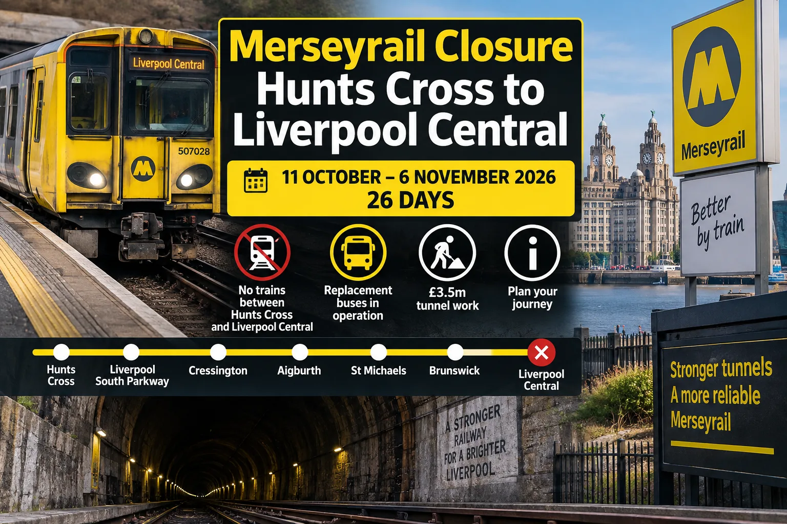
Liverpool Central is the better station for Bold Street, Church Street and Ropewalks. It serves both the Northern and Wirral lines and also has step-free access. Moorfields is useful for Dale Street and the commercial district, and James Street puts you closest to Pier Head.
For the wider network, our guide to getting around Liverpool without a car covers Merseyrail, buses, ferries, contactless travel and the airport.
Lime Street, St George's Hall and William Brown Street

This is one of the easiest parts of the centre to use without much planning. St George's Hall faces the station. Behind it, William Brown Street holds Central Library, World Museum and the Walker Art Gallery within a short stretch.
That makes this end of town useful when the weather turns, or when you have an hour or two before a train. You generally come here for a museum, the library, an event, the courts or St George's Hall itself, rather than to drift around.
From here you can walk downhill towards Church Street and Liverpool ONE, or up towards Hope Street and the Georgian Quarter.
Shopping around Church Street and Liverpool ONE
Liverpool's main retail core runs through Church Street, Lord Street and Liverpool ONE, which stretches down towards Paradise Street and the waterfront.
Liverpool ONE publishes general centre hours rather than pretending every retailer keeps the same times, so check an individual shop before travelling specifically for it.
For independent shopping, move away from the retail core towards Bold Street and the Ropewalks streets around it. Our guide to independent shops in Liverpool covers books, records, clothes, gifts and art materials on and near Bold Street.
Bold Street
Bold Street runs uphill from Liverpool Central towards St Luke's Church, the bombed-out church left as a memorial.
It is one of the most useful streets in the centre if you want food and independent businesses without moving between districts. Bookshops, record shops, vintage clothing, homeware, cafes and restaurants across several cuisines sit along it. The mix changes often, which is why a street-level guide is more use than a long list frozen into this page.
See our Bold Street guide for current businesses and recent changes. Note that the street is on a noticeable slope and gets busy at weekends. Liverpool Central sits at the lower end.
Ropewalks, Wood Street and Duke Street

Ropewalks begins around Bold Street and spreads through Wood Street, Seel Street, Slater Street and the Duke Street side of the centre. This is where the daytime city centre and the night-time city centre start to overlap.
FACT is at 88 Wood Street. It combines free contemporary art exhibitions with Picturehouse cinema screens, a cafe and a bar, and the building and galleries have wheelchair access. Opening hours differ between the main building, the galleries and the cinema, so check before a specific trip.
The surrounding streets hold restaurants, pubs, bars, clubs, tattoo studios and independent businesses. Venues change quickly here, so use current listings rather than an old guide. For more detail, see our Ropewalks area page.
Bluecoat and the quieter side of the retail centre
Bluecoat sits on School Lane, behind the main shopping streets. It holds a free gallery, a cafe, a garden, independent shops and creative studios. The gallery is usually open Tuesday to Sunday, but check its visitor page before making a special trip.
This is a useful indoor stop if you are already around Church Street or Liverpool ONE and do not want to walk to the waterfront or William Brown Street.
Castle Street and the commercial district
Castle Street runs between Liverpool Town Hall and Derby Square. Its character is different from Bold Street: restaurants and bars share the street with offices, banks and civic buildings, and Dale Street and Water Street extend the commercial district around it.
Castle Street also gives you a straightforward route towards Pier Head. If you need lunch rather than a full itinerary, our casual lunch guide splits the centre between Bold Street, Castle Street, Ropewalks and the waterfront.
Pier Head and the Liverpool waterfront

Cross The Strand and the centre changes again. Pier Head holds the Royal Liver Building, the Cunard Building and the Port of Liverpool Building, with the Museum of Liverpool, the ferry terminal and the Royal Albert Dock immediately around it. James Street is the most useful Merseyrail station for this side.
One temporary change matters: the Maritime Museum and International Slavery Museum at the Royal Albert Dock are closed for redevelopment. National Museums Liverpool's waterfront transformation project plans to reopen the International Slavery Museum later this decade. The Museum of Liverpool stays open.
For the waterfront itself, use our Liverpool Waterfront area guide or the Pier Head to the Marina walking route, which covers the current museum closures, access and stations.
Hope Street and the Georgian Quarter
Hope Street sits above the retail centre rather than inside it. It connects the Metropolitan Cathedral and Liverpool Cathedral, passing the Everyman Theatre, the Philharmonic Hall, university buildings, restaurants and pubs.
It combines easily with Lime Street or Ropewalks, but the gradient matters. Walking from the lower centre towards the cathedrals is a steady climb. Our Hope Street guide has a cathedral-to-cathedral route.
Eating in the city centre
There is little reason to cross the whole centre just for lunch. Bold Street and Ropewalks give the largest run of casual choices around Liverpool Central. Castle Street works around the business district. Liverpool ONE keeps you close to the shops, and the Royal Albert Dock makes sense when that is already where you are heading.
The city-centre casual lunch guide and the Bold Street guide go into individual places, so this page can stay focused on orientation.
Getting around the centre on foot
Once you are inside the centre, walking usually beats moving again by car or public transport. The main exception is when mobility, luggage or weather makes a short station-to-station hop worth it.
The terrain changes more than a flat map suggests. The waterfront is level. Bold Street rises towards St Luke's. Hope Street and the Georgian Quarter sit higher again.
If you are trying to see Liverpool rather than run errands, pick two neighbouring sections and spend time there. The waterfront plus Liverpool ONE works well. Bold Street plus Ropewalks does too. Lime Street and William Brown Street pair with Hope Street. Trying to fit the waterfront, Ropewalks, the Georgian Quarter, the shops and the museums into one short visit mostly means crossing town rather than looking at anything.
Parking in the city centre
Liverpool City Council runs paid on-street parking across the inner city-centre zone, with charging hours and maximum stays that vary by street. Check the council's inner zone parking page for current charges rather than relying on an old figure. Blue Badge holders can usually park free in council pay-and-display bays, subject to the normal time limits.
For most trips from within Merseyside, rail or bus removes the need to find a space and then walk back across the centre.
Accessibility
There is no single accessibility answer for the whole centre. Lime Street and Liverpool Central both have step-free access to platforms. FACT lists its public areas, galleries and cinema screens as wheelchair accessible. Bluecoat has wheelchair access through its newer wing and gallery spaces but notes restrictions in parts of the older listed building.
Historic paving, slopes, crowds and temporary works can still affect individual routes. For a specific venue, station or event, check its own access page rather than relying on a general guide.
Where to go after the city centre
Ropewalks leads naturally towards the Baltic Triangle. Hope Street takes you into the Georgian Quarter and the university district. The waterfront continues south through King's Dock towards the marina.
Merseyrail from Central, Moorfields and Lime Street gives you quick access to neighbourhoods outside the centre, which is often a better use of the rest of the day than stretching the city-centre walk further.



.jpg)

_(2).jpg)

