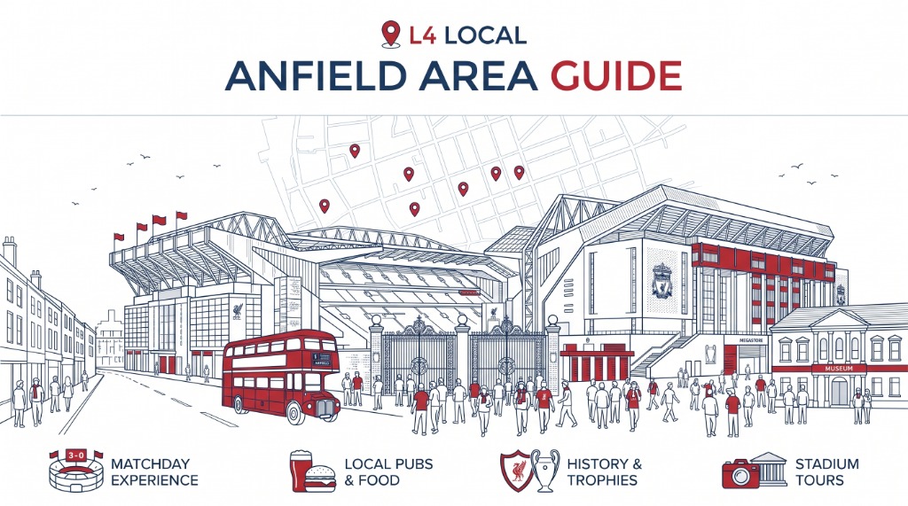
Anfield is one of Liverpool's best-known place names, but the neighbourhood is more than the football stadium that shares its name. Around Anfield Road and Walton Breck Road are tightly packed residential streets, local shops and pubs, Stanley Park, the vast Anfield Cemetery and more than a century of football and housing history.
This guide covers Anfield as a neighbourhood: where it sits in north Liverpool, how it developed, what changes on a matchday, how to get around, the local places that matter, and the regeneration and roadworks changing parts of the area in 2026.

Current information
Walton Breck Road is undergoing a major highways upgrade. Work is affecting routes around the stadium and is expected to continue into 2027. Matchday transport and road restrictions can also change by fixture, so check the latest official information before travelling.
Anfield at a glance
- Area: north Liverpool, principally around the L4 postcode.
- Main roads: Anfield Road, Walton Breck Road, Oakfield Road, Breck Road, Priory Road, Arkles Lane and Utting Avenue.
- Best-known landmark: Anfield Stadium, home of Liverpool FC.
- Other major landmarks: Stanley Park and Anfield Cemetery.
- Stadium capacity: 61,276.
- Nearest useful Merseyrail stations for the stadium: Sandhills and Kirkdale, although neither is beside the ground.
- Matchday link from rail: Soccerbus runs between Sandhills and Anfield for Liverpool FC home matches.
- Weekly market: Stanley Park Market normally runs on Wednesdays, except when an LFC match prevents it.
- Current disruption: Walton Breck Road improvement works are under way in 2026 and are expected to continue into spring 2027.
Where Anfield is
Anfield sits north of Liverpool city centre, between areas including Everton, Kirkdale, Walton and Tuebrook. The everyday idea of "Anfield" does not fit neatly inside one boundary, so it is more useful to understand the area through its main streets and landmarks than to pretend there is an agreed line around it.
For most people, the centre of gravity is the junction of Anfield Road and Walton Breck Road, beside Liverpool FC's stadium. Stanley Park lies immediately to the north and west of the ground. Anfield Cemetery stretches across a large site farther east around Priory Road.
Liverpool City Council also uses wider administrative boundaries that do not always match the way residents describe neighbourhoods. The council's current neighbourhood model places the Anfield ward alongside Everton North, Everton East and Everton West in the Stanley Park neighbourhood.
That distinction matters when looking up council services, ward data, consultations or local representatives. An address described locally as being in Anfield may appear inside a wider council neighbourhood or close to a ward boundary. For the surrounding districts, see L1Local's north Liverpool guide.
Anfield is a residential neighbourhood first
Football brings tens of thousands of people into Anfield, but most days the area is a dense residential part of north Liverpool.
Rows of late-19th and early-20th-century terraced houses remain a defining part of the streetscape. Shops and takeaways cluster along roads including Walton Breck Road, Breck Road and Oakfield Road. Schools, churches, community organisations and everyday services sit among streets that can look completely different a few hours before a major match.
That contrast is central to understanding Anfield. A visitor arriving for Liverpool FC may meet closed roads, packed pavements, temporary food stalls, queues and busy pubs. A resident using the same streets on a weekday is dealing with an ordinary local high street, school traffic, buses, shopping and housing.
It is also why matchday management is not simply a question of getting supporters into the ground. Parking controls, road closures, pedestrian flows and short-term visitor accommodation all affect people who live around the stadium.
How Anfield developed from fields to terraces
Anfield was still semi-rural well into the 19th century.
National Museums Liverpool's historic character assessment records an early form of the place name as Hongfield in 1642, deriving it from words meaning a field on a slope. "Annfield" was recorded in 1786. The same study describes the area historically as land used for cattle grazing and quarrying before enclosure and Liverpool's urban expansion changed its character.
The first-edition Ordnance Survey map of 1851 did not show an established Anfield town centre. The landscape was largely open fields with scattered villa housing, with a developing group of properties around the meeting of Priory Road, Breck Road and Townsend Lane, Walton Breck Road and Lower Breck Road.
Liverpool's rapid growth changed that. As the city expanded, workers' terraces increasingly replaced open land and detached villas. The late-19th-century housing around Anfield formed part of a much wider shift away from the overcrowded court housing that had characterised parts of central Liverpool.
Two enormous pieces of public landscape arrived during that transformation: Anfield Cemetery, opened in 1863, and Stanley Park, opened in 1870. Football followed soon afterwards.
Everton played at Anfield before Liverpool FC existed
One of the easiest parts of Anfield's history to overlook is that Liverpool FC was not the first club to play at the stadium.
Everton moved to Anfield in 1884. The club played there for eight years and won the Football League championship while based at the ground. A dispute involving club president John Houlding and Everton's committee eventually led Everton to leave Anfield in 1892 and establish a new ground at Mere Green, which became Goodison Park.
Houlding was left with a football ground but no team. Liverpool Football Club and Athletic Grounds Limited was formally recognised on 3 June 1892. Liverpool then began playing at Anfield, creating the unusual situation in which the history of both of the city's major clubs runs directly through the same patch of north Liverpool.
The nearby Sandon, on Oakfield Road, is also part of that history. Liverpool FC identifies it as the place where the club was formed in 1892.
The stadium has since expanded repeatedly. Following the redevelopment of the Anfield Road Stand, Liverpool FC confirmed the current stadium capacity as 61,276.
What changes in Anfield on a matchday
Home matches can alter movement across the neighbourhood for several hours.
The biggest change is around the stadium itself. Roads close, traffic is diverted, parking restrictions are enforced and large numbers of supporters approach on foot from buses, taxis and surrounding streets. Pubs, takeaways and food outlets become much busier than on a normal weekday.
If you are going to a match, the safest assumption is that a journey which looks short on a map may take much longer close to kick-off.
Liverpool FC currently recommends public transport where possible. The club also operates a resident-only parking scheme around Anfield, and general matchday parking immediately beside the stadium is limited.
L1Local has a separate Anfield and north Liverpool matchday guide for readers whose main concern is getting to a game rather than exploring the neighbourhood.
Current Walton Breck Road restrictions
There is an extra complication during the 2026/27 season.
Liverpool City Council began a multi-phase programme of works on Walton Breck Road in May 2026. The project includes highway repairs, resurfacing, utility work, new or upgraded bus infrastructure and pedestrian improvements. The council said the overall programme was due to be completed in spring 2027.
Liverpool FC issued an updated travel warning in August 2026 stating that works between Oakfield Road and Sleepers Hill were affecting both drivers and pedestrians. The scheme includes widened pavements, new crossing points and carriageway resurfacing.
At the time of writing, a single-lane closure is operating on part of Walton Breck Road, with traffic running one way from Oakfield Road towards the city centre. The club has also moved the temporary matchday taxi rank from beside the Paisley Gates to Venmore Street.
These arrangements are time-sensitive. Check the latest Liverpool FC Anfield travel update and Liverpool City Council's Walton Breck Road information before relying on a particular route.
Getting to Anfield Stadium
Anfield Stadium is roughly two miles north of Liverpool city centre. There is no railway station directly outside the stadium, so most journeys involve a bus, Soccerbus, taxi or a walk for the final part.
From the city centre by bus
The 917 express is one of the most direct matchday options. Liverpool FC says it runs from Commutation Row, close to Lime Street station, to Anfield in around 15 minutes, with return buses using Walton Lane after the match.
Other services serving roads near the stadium include the 17 from Queen Square, the 26 from Liverpool ONE, and routes including the 14, 19 and 68/168. Special matchday services may also operate. Timings and routes can change, especially around fixtures and roadworks, so check current Merseytravel or Liverpool FC information before setting off.
By Merseyrail and Soccerbus
Sandhills is the main rail connection for Soccerbus. Merseyrail's current service information says Soccerbus operates from Sandhills station to Anfield on matchdays. The service runs before Liverpool FC home games and returns to Sandhills after the final whistle.
The published timetable currently says services can begin up to three hours before a game, with the last bus leaving Sandhills approximately 15 minutes before kick-off and return buses operating for around 90 minutes after the match, subject to availability. Merseyrail publishes current fares and accepted travel passes on its Soccerbus information page.
Walking
It is possible to walk from central Liverpool to Anfield, but it is a substantial walk rather than a quick extension of a city-centre visit. Liverpool FC says Sandhills and Kirkdale stations are each around a 30-minute walk from the stadium, and routes from the County Road and Goodison side include uphill sections. On matchdays, pedestrian routes can also be affected by crowd-control measures and temporary road arrangements.
Cycling
Liverpool FC operates a Cycle Hub at the top of Stanley Park car park on matchdays. Supporters can register and leave a bicycle in the secure hub. The club advises cyclists to bring a lock.
Driving and parking
Driving directly to the stadium is usually the least flexible option on a matchday. The streets around Anfield are residential and subject to parking controls. Liverpool FC says there is no general paid matchday parking on Stanley Park car park or Utting Avenue, apart from specific pre-allocated spaces.
Do not assume an apparently empty residential street is legal matchday parking. Enforcement operates around the stadium, and closures can affect the route back out after the match. For many drivers, parking at a rail station or elsewhere on the transport network and finishing the journey by train or bus is more predictable.
Accessibility around Anfield Stadium
Liverpool FC publishes a detailed stadium accessibility guide rather than relying on a single generic drop-off point. The club's March 2026 access statement lists dedicated or recommended accessible drop-off areas including:
- Gilman Street for the Main Stand and Kop.
- Arkles Lane and Wylva Road for the Anfield Road Stand.
- Oakfield Road for the Sir Kenny Dalglish Stand.
Vehicle access close to the stadium can be restricted before kick-off, so anyone who needs an accessible drop-off should check the current arrangements for the specific fixture.
Liverpool FC also states that the 917 and Soccerbus services are accessible. Sandhills and Kirkdale have step-free access between trains and platforms, although the onward journey still needs planning. Use the club's current accessibility information rather than an old matchday map, particularly while Walton Breck Road works are continuing.
Stanley Park
Stanley Park gives Anfield a large piece of open space immediately beside the stadium. Liverpool City Council describes it as a 111-acre park containing formal gardens, lakes and the Isla Gladstone Conservatory. Historic England records the park as Grade II* and says it was designed by landscape designer Edward Kemp in 1867, opening in 1870.
The park was not designed purely as ornamental space. Historic England's listing notes that its layout deliberately included large areas of open grassland for football and other contact sports. That makes its location between Anfield and Goodison particularly appropriate, even if the scale of the football grounds that eventually developed beside it could never have been anticipated in 1870.
The surviving landscape combines formal terraces, open lawns, winding paths and the lake. Historic England also highlights the relationship between Stanley Park and neighbouring Anfield Cemetery, another Kemp landscape. The council gives the park's address as Walton Lane, Anfield, L4 2SL.
For someone coming to Anfield outside a football fixture, Stanley Park is one of the clearest reasons to see the neighbourhood as more than a stadium stop.
Stanley Park Market
A weekly market returned to Stanley Park in 2026. Liverpool City Council says Stanley Park Market operates from the Stanley Road Car Park on Priory Road. It reopened on 1 April 2026 and normally runs every Wednesday from 9am to 3pm, unless there is a Liverpool FC match.
The council says the market can hold up to 100 stalls, including produce, clothing, homeware, crafts and food and drink. The site is beside the Anfield Road Stand end of the stadium. Bus routes listed by the council include the 17 group on Arkles Lane and the 68 group on Priory Road.
Because matchdays can replace the normal Wednesday schedule, check the official Stanley Park Market page before travelling specifically for it. L1Local also includes the market in our Liverpool car boot sales and second-hand markets guide.
Anfield Cemetery

Anfield Cemetery occupies roughly 110 acres off Priory Road, making it one of the largest historic spaces in this part of Liverpool. Liverpool City Council says the cemetery was designed by Edward Kemp and opened in 1863. Like Stanley Park, it is Grade II* listed. Its layout follows a formal French-influenced design, with three original chapels and entrances designed by Liverpool architects Lucy and Littler. A crematorium was added in 1896.
The scale of the cemetery is easy to underestimate from the surrounding roads. It is not a small churchyard but a planned Victorian landscape with long avenues, monuments and a large collection of graves connected to generations of Liverpool families.
The Friends of Anfield Cemetery have developed the Lifting the Lids heritage trail, which identifies people buried there and uses their graves to tell parts of the city's history.
The main council address is 238 Priory Road, Anfield, L4 2SL. The council does not publish fixed daily opening hours because access varies through the year, but says the gates are generally open from dawn until dusk. Anyone researching a family grave can use the cemetery section map published by Liverpool City Council. Exact individual grave locations are not available as a complete public map.
Homebaked and community-led regeneration
One of the most useful places for understanding modern Anfield is not inside the stadium.
Homebaked Bakery, at 197-199 Oakfield Road, is a community bakery operating on one of the main approaches to the ground. Its current published opening hours are 8am to 3.30pm, Monday to Saturday.
The bakery grew out of a wider community-led response to regeneration around Anfield. The organisation formerly known as Homebaked Community Land Trust now operates as Two Up Two Down, while the bakery continues under the Homebaked name.
Two Up Two Down describes itself as a community land trust seeking to protect and develop affordable homes, workspaces and community assets. Its account of the neighbourhood is useful because it shows another side of stadium-led change: local concern about family housing, property speculation and the growth of short-term accommodation around football fixtures. The organisation traces its roots to work that began in 2010 and says a campaign in 2012 helped save and renovate the bakery building.
That history makes Homebaked more than a convenient pre-match food stop. It is directly connected to debates about who regeneration is for and how investment around the stadium can benefit the people living there all week. See L1Local's Homebaked listing for practical business information.
Pubs, food and everyday shopping
Food and drink around Anfield splits into two different patterns. On ordinary days, Oakfield Road, Breck Road and Walton Breck Road work as local shopping streets with bakeries, takeaways, convenience shops and pubs serving residents. On matchdays, businesses close to the stadium can become extremely busy, and temporary vendors appear around the approaches to the ground.
Two established names have a direct connection with the area's football history. The Sandon, at 178-182 Oakfield Road, is linked to the formation of Liverpool FC in 1892 and is now also used as an official matchday hospitality venue. Cabbage Hall, at 20 Breck Road, is another long-running pub name in the area; "Cabbage Hall" has also historically been used for the southern part of Anfield.
If the purpose of your visit is a match, being close to the ground generally matters more than crossing Liverpool for a particular meal immediately before kick-off. Queues, road closures and packed buses can remove most of the margin from a tight plan. For broader options across the city, see L1Local's where to eat in Liverpool by area guide.
The regeneration of the streets around Anfield
The physical changes around the stadium did not begin with the current Walton Breck Road works. Liverpool City Council adopted the Anfield Spatial Regeneration Framework in 2014. The wider programme combined housing, public realm, commercial development and changes associated with the expansion of Anfield stadium.
By 2024, the council said the wider Anfield investment programme had delivered more than 600 new homes and more than 500 refurbished homes, alongside work to Stanley Park and other neighbourhood improvements. Those are council figures describing the programme as a whole, not a claim that every regeneration problem in Anfield has been resolved.
The current road programme is another stage of that long-running work. It is particularly visible because Walton Breck Road is both a local high street and one of the main pedestrian routes to the stadium.
Regeneration in Anfield therefore has two audiences that do not always need the same thing. Visitors need safe movement around a 61,000-capacity football ground. Residents need housing, usable pavements, local shops, public transport and streets that function on the other 300-plus days of the year. That tension is one reason community organisations such as Two Up Two Down remain relevant to the story.
What Anfield is like away from football
Outside a match or stadium event, Anfield is much easier to move around. There are still football visitors taking stadium tours and visiting the club museum, but the huge temporary crowds disappear. Roads around the ground function more like ordinary residential streets, local shops serve their regular customers and Stanley Park becomes much more prominent as a neighbourhood space.
For visitors interested in Liverpool history, an off-matchday visit also makes it easier to connect several sites on foot: the stadium, Stanley Park, Anfield Cemetery and the streets around Oakfield Road and Walton Breck Road. The area makes more sense when its football history, Victorian landscapes, terraced housing and current regeneration are read together.
Stadium tours and the Liverpool FC museum
Anfield can be visited when there is no match through Liverpool FC's stadium tour and museum operation. Tour availability varies around fixtures, events and stadium operations, so book through Liverpool FC rather than relying on a third-party timetable. Tours can include areas of the stadium that are normally inaccessible to general visitors on a matchday.
This is also the better option for anyone primarily interested in the architecture and history of the ground rather than the matchday atmosphere. Check the official Liverpool FC stadium tour booking site for current tour types, dates and prices.
Practical addresses
| Place | Address or location | Useful detail |
|---|---|---|
| Anfield Stadium | Anfield Road, Liverpool, L4 0TH | Liverpool FC home ground, capacity 61,276 |
| Stanley Park | Walton Lane, Anfield, L4 2SL | 111-acre Grade II* public park |
| Anfield Cemetery | 238 Priory Road, Anfield, L4 2SL | Grade II* cemetery, gates generally dawn to dusk |
| Stanley Park Market | Stanley Road Car Park, Priory Road, Anfield, L4 0TQ | Wednesdays, normally 9am to 3pm unless an LFC match |
| Homebaked Bakery | 197-199 Oakfield Road, Anfield, L4 0UF | Community bakery, currently Monday to Saturday |
| The Sandon | 178-182 Oakfield Road, Liverpool, L4 0UH | Pub and official LFC hospitality venue with a club-history connection |
Before travelling to Anfield
For a normal weekday visit, ordinary journey planning is usually enough. For a Liverpool FC home match, major stadium event or a period of roadworks, check again on the day. In particular:
- Check the fixture and kick-off time. Anfield's traffic pattern can change several hours before the match.
- Check current bus or Soccerbus information. Matchday services are useful but are still subject to operational changes.
- Do not rely on street parking beside the ground. Resident parking restrictions and enforcement operate around the stadium.
- Allow for Walton Breck Road works during 2026/27. Pedestrian and vehicle routes may differ from an older map.
- Check accessibility arrangements before arriving. Drop-off locations depend on the stand and can be affected by road closures.
- Check Stanley Park Market before a Wednesday trip. It does not operate when an LFC match conflicts with the normal market day.
Nearby areas
Anfield connects directly into several north Liverpool neighbourhoods. Kirkdale lies to the west, with rail links and routes towards the north docks. Everton is to the south-west, with Everton Park and routes back towards the city centre. Walton is north and north-east, including County Road and Walton Hall Park. Tuebrook and Breckside sit east and south-east along the Breck Road corridor. For broader context, start with L1Local's north Liverpool area guide.